NOTE: THIS IS NOT A MEMBERSHIP APPLICATION.
CLICK HERE FOR INFORMATION ON HOW TO JOIN BCSO/SAR
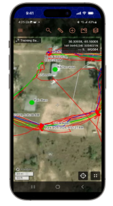 The CalTopo/SARTopo PHONE APP works with your cell phone and is a required item for ALL team members.
Our next “move” into the 21st century involves real time GPS tracking of our SAR activities. This is a BCSO agency wide item that I’ve been tasked to help implement. The software/app that will be used is called CalTopo and works with your cell phone.
Links to get the app are below and all members should install it on their phone:
Some quick training and familiarization …
Once installed you’ll notice the app has many features, but the main item used by our team members can be found in the lower right corner of the app – the button with the 4 dots …
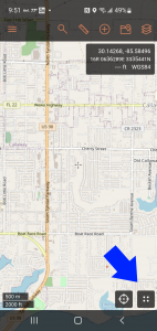
Touching that will bring up the following menu:
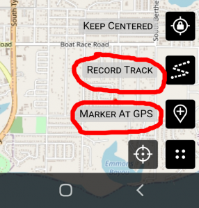
RECORD TRACK: starts using the GPS system on your phone to record your movements/progresss
MARKER AT GPS: Used to mark a spot of interest (i.e. item, evidence, point of interest)
This data can then be transferred to the Command center / our command post and superimposed on a map. Sharing the information to easy. Just click on the 3 bars in the upper left corner:
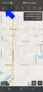
From the menu shown, select Tracks:
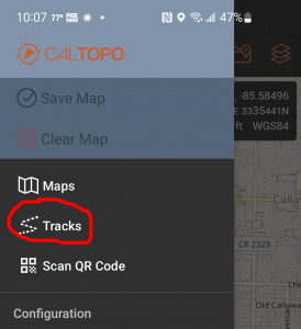
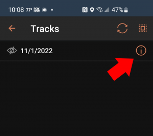
This will bring up a list of the GPS Tracks saved on your phone. Touch the “i” selection and you’ll be able to share/upload to the main map.
Example:
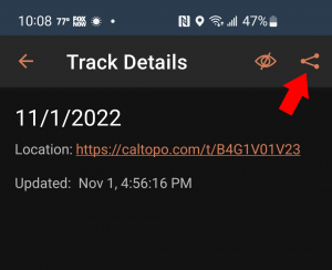
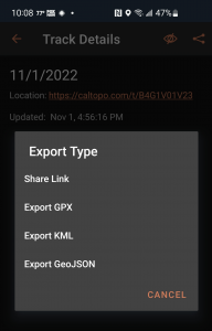
Don’t worry about the Export type, we’ll cover this during hands on training.
Please try it out so that you are at least comfortable in starting a track, marking a GPS spot and getting to the export screen.


